
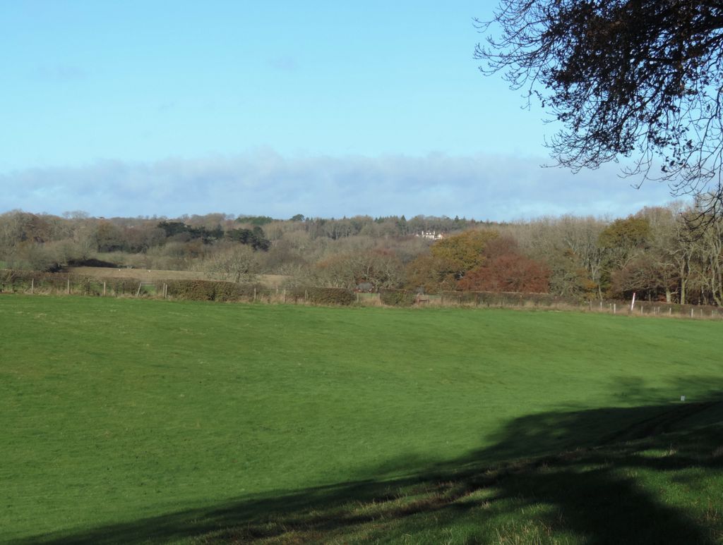
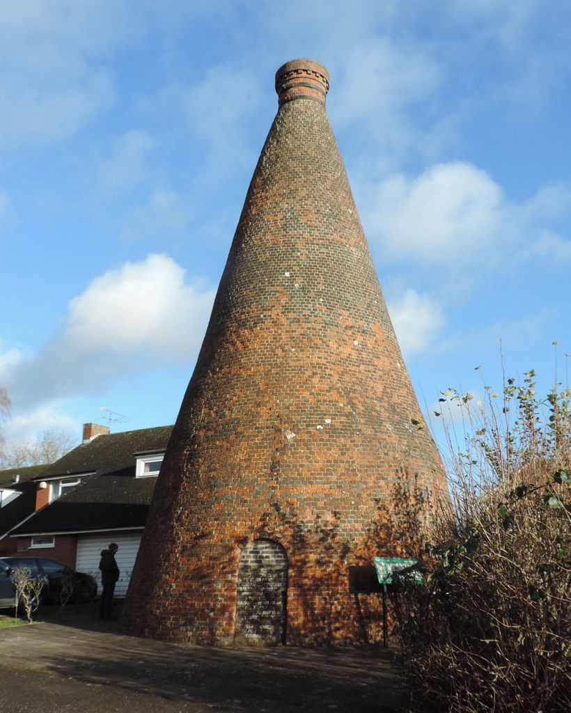
Professor Peter Worsley led a well attended walk on the morning of Saturday 4 December to look at the geology of Nettlebed Common. It was a sunny morning but there was a bitterly cold wind. Peter started by handing out maps of the Common, with dark orange for the Lambeth Beds, surrounded by a halo of a lighter brown for Clay-with-flints and with fingers of light green for the dry valleys of the underlying Chalk. At the centre of the Common were several small pink patches representing London Clay on top of the Lambeth Beds. He then showed a larger-scale geological map of the Chilterns, showing the south-west to north-east line of the Chiltern escarpment and the areas of Lambeth Beds and Clay-with-flints on the dip slope. The walk started out in an easterly direction, until Peter turned right into a pathless stretch of woodland, heading for a deep fenced-off hole. The hole was deep with straight sides and was formed about 8 years ago when a section of old Chalk mine collapsed. The Common used to be a hive of industry, with its brick and tile works. Brick making requires clay, together with smaller amounts of chalk and wood. Clean chalk is required, which is why it was mined, rather than collected from the surface. The hole was described as a ‘crown hole’. Returning to the road, the map showed it marked the boundary between the Chalk on the right and the Lambeth Beds on the left. The route then turned left along a narrow path through woodland which led to the next hole. This was much wider and shallower than the previous hole. There were no obvious entry or exit channels for surface water and Peter suggested that this might be another case of mining subsidence. However, one of the members who does a lot of conservation work on the Common commented that the flooded clay pits higher up the hill regularly overflow over the disputed area. The third hole which Peter pointed out was much more likely to be a swallow hole. Two channels led into the double hole and another channel drained it, so surface water would have been available to trigger its growth. Continuing north-westwards, the next track had a drop of about 4 metres on its right hand side to the top of the area where material for the old Soundess kiln had been extracted. The track continued to the house called Magpies, which was situated at the boundary between the Lambeth Beds and the Chalk. Wide views opened up across the open farmland on the Chalk and a dry valley led north-eastwards from the property. This would have been carved out by surface meltwater at the start of a warmer interglacial period when the normally permeable Chalk would have been rendered impermeable by permafrost.
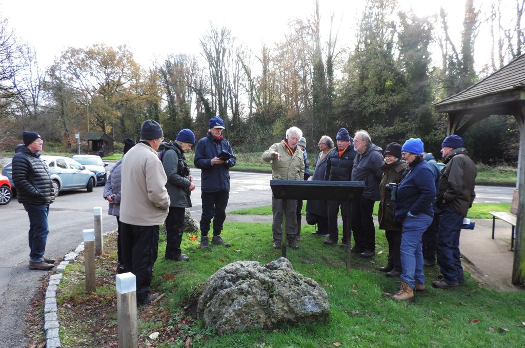
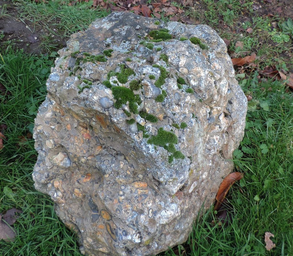
Next stop was Priests Hill, where Gorse and Heather mark out the acid soils of an area of gravel. Peter strongly disagreed with the interpretation of the geological history of the site as presented on the information board by the Chilterns Conservation Board. According to the sign, the gravel was the highest and oldest of the Thames gravels, laid down 2 million years ago when the Thames flowed to the north of the Chilterns, entering the North Sea near Ipswich. In a later glacial period when ice sheets blocked its course, the Thames cut through the Goring Gap, 150 metres lower than Priest Hill. Peter commented that it was improbable that there should only be a single site for these gravels, so high above and far away from any other Thames gravel deposits. He said that they were more likely to be Tertiary gravels, part of the Lambeth Beds. He also said that the Thames was unlikely ever to have flowed there. Instead, it had remained near its current location, but that as erosion gradually removed materials from its course, the land slowly rose. The river cut its way more deeply through the Goring Gap as the ground around rose and the river maintained its level. Nearby, a pit had been dug to investigate the soil profile. Organic deposits had been found which had a pollen spectrum unique to the area. Peter suggested that they came from the surface of an area of subsidence in an interglacial period about 2 million years ago. The walk then continued through an intensively mined landscape. Peter pointed out a bed of pebbles. These were rounded, indicating that they had been on a beach at some point, and showed ‘chatter’ marks – zig-zag lines characteristic of beach pebbles. Amongst the flint pebbles were a few rounded quartzite stones. Peter said that these were Tertiary layers. The walk continued to Windmill Hill, the highest point in the south-western Chilterns. It is capped by London Clay, laid down about 50 million years ago. Final stop was the Green, where two puddingstones can be seen on the grass next to the bus shelter. These are a conglomerate of rounded flint pebbles within a sandstone matrix. They had formerly been in the courtyard of the Bull Inn in the High Street, where they had been used as mounting blocks, but had since been relocated to their current position. Once again, Peter disagreed with the information on the adjacent sign board. According to the sign, the puddingstones formed a layer between the Lambeth Beds and the London Clay and had been formed about 50 million years ago in desert conditions when flash floods carried pebbles and sand into river channels. Wind blew quartz dust into the cracks between the sand grains and then night time dew moistened the quartz and encouraged quartz crystals to grow, cementing the blocks together. Freeze-thaw of the ice ages then broke up the blocks and moved them around. According to Peter, the puddingstones formed as lenses within the Lambeth Beds. They formed beneath river beds in a hot, arid environment. Silica dissolved in the water crystallised out as water percolated upwards and evaporated, filling the cavities between the pebbles and cementing them together. They were broken up by more recent erosion.

Nettlebed Common 
Dry valley 
Pebble bed 
Puddingstone information 
Puddingstone 
Nettlebed Kiln


Pictures by Rob Stallard